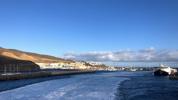
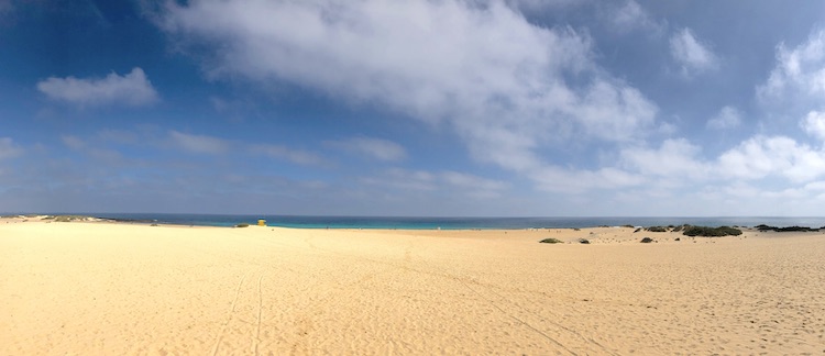
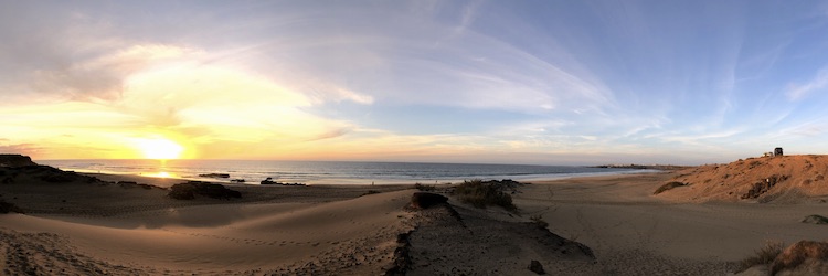
I took the ferry from Lanzarote to Fuerteventura on a weekend, so I had some time to explore the northern part of the second-largest of the Canary Islands. The ferry landed in Corralejo. I didn’t feel like spending time in a city and drove right into the expansive sand dunes of the Parque Natural de Corralejo. The pristine beaches looked amazing.
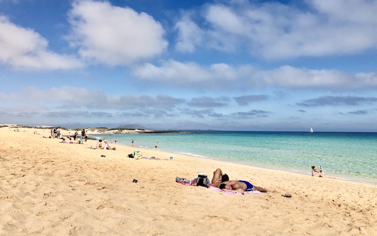
The water was crystal clear and at the right temperature for a swim.
Another Mercedes T2 caught my attention when I came back from the beach. It was a nice 608D, the big brother of my 508D ![]()
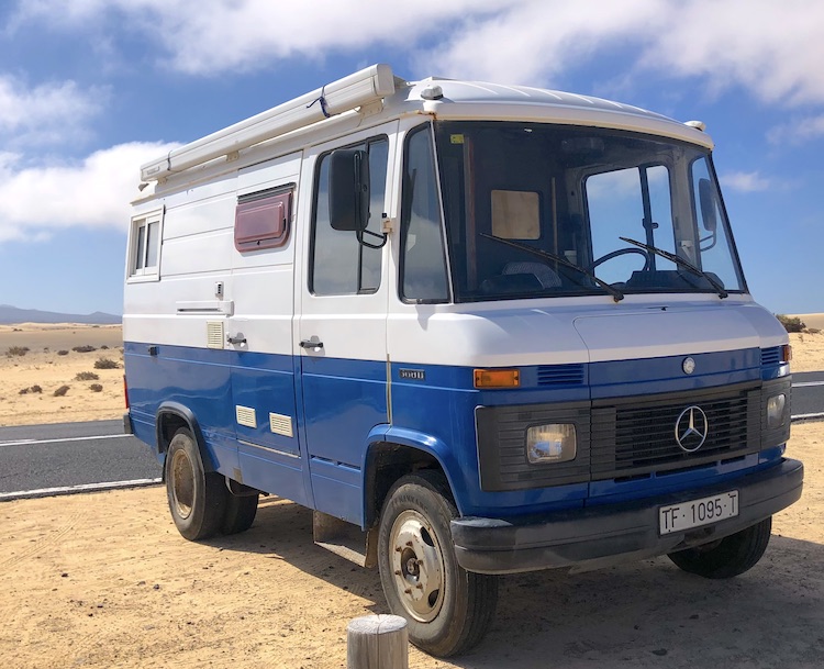
Unfortunately, the owners weren’t present, so I couldn’t have a look at the interior. When I came back a second time, they 608D was already gone. Maybe next time?
Someone knocked on my door during my lunch break and greeted in German. A German cyclist recognized my German license plate and wanted to say “Hallo”.
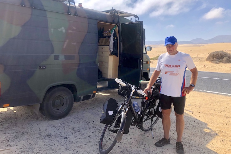
He started his bicycle tour in Germany about four months ago and was exploring the Canaries, too. We had a nice conversation and took pictures of each other before going our own ways.
Cruising in the North
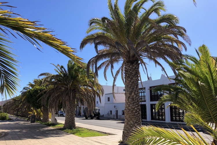
Inspired by the bicycle stories, I drove into the hinterlands looking for some volcanos to ride my mountain-bike. However, I got distracted by strolling through the streets of La Oliva, a small town in the middle of the northern part of the island.
It was really warm and the sun was burning, so I abandoned my cycle plans and decided to follow a dirt road along the northern coast. I ended up at El Hierro, a famous surf spot on Fuerteventura.
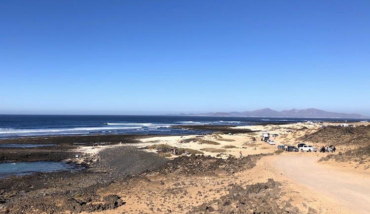
The surf conditions were great and the area was packed with cars, pick-ups and vans. I spent a couple of hours at El Hierro before heading further down south to El Cotillo in the evening. It was much easier to find a spot to park my van evenly in front of Playa del Castillo.
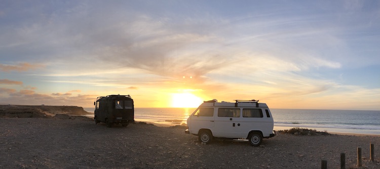
Hanging out with Marco
Marco, the owner of the Volkswagen T3 next to my van, came all the way from Denmark to surf and enjoy the good weather. He’s also a software engineer and has taken a break from work to relax and recalibrate. We got along quite well and spent several days together at Playa del Castillo.
While Marco went surfing, relaxed or worked on his new blog during the day, I usually worked in my van.
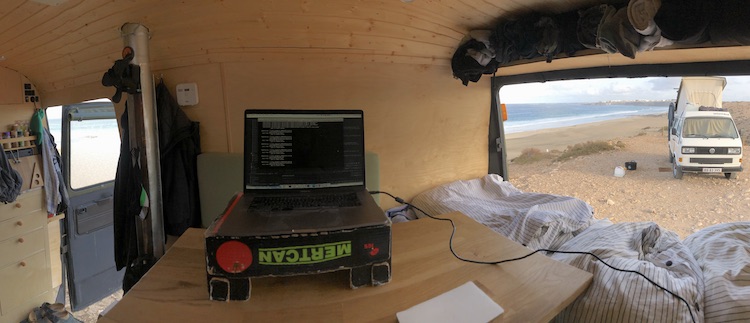
Nevertheless, we spent a lot of time together, either during my breaks or the amazing sunsets after work.
Attempting to drive off road
After hanging out with Marco for a week, I left Playa del Castillo headed south. I passed Llanos de la Concepción and followed a dirt road.
I wondered about the great condition of the road although there weren’t any signs. Neither did my map show any village that this road would lead to. The sun started setting after following the road for about 30 minutes. Before it turned dark, I found a nice bay with a lot of green plants.
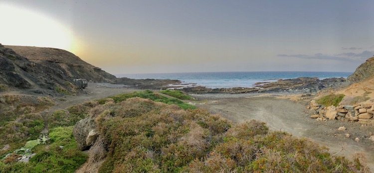
Something that I haven’t seen for a long time on these dry islands. It was easy to locate the reason for all the green colors: a natural spring.
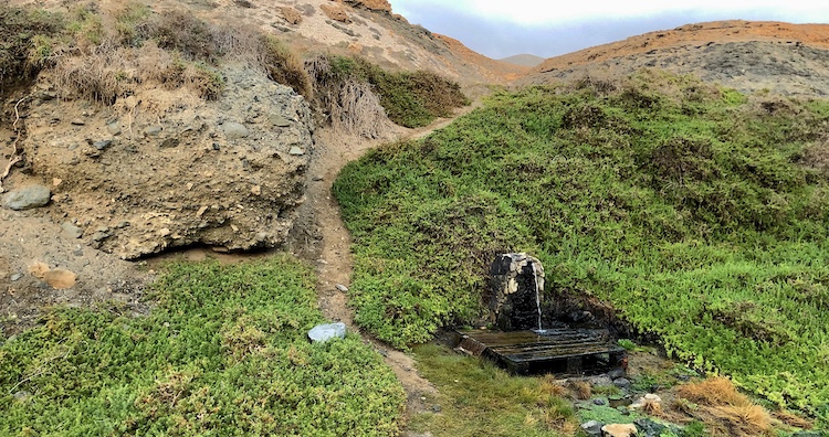
The water was very clear and didn’t smell at all. Perfect to fill up my tank!
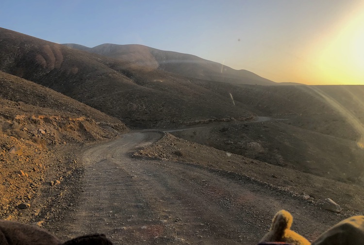
In the next morning, I kept following the dirt road which started turning into a path.
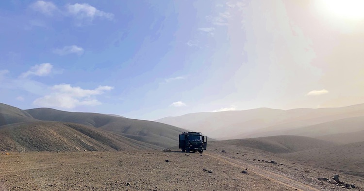
The further I drove, the worse the “path” became.
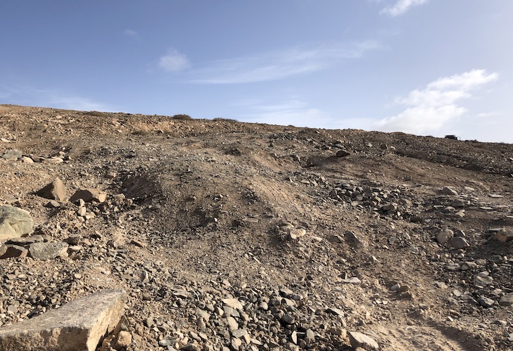
I had to cross several canyons. After slightly touching the ground with the front axle and spinning the wheels in the first gear on a steep slope, I started questioning if I should keep driving further. I had no idea what I had to expect until reaching Ajuy, the next village which was about 10km away. My van is not a 4x4 off road truck. I can’t even lock the differential. Was it worth to accept the risk of getting stuck or breaking my van in one of these canyons in the middle of nowhere?
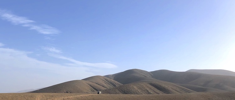
Nope! I decided to return. ![]()
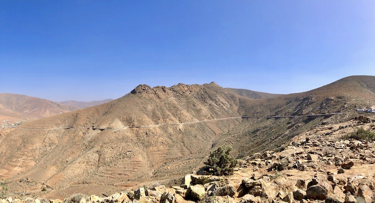
Crossing Rural Park Betancuria
Taking the paved road to Ajuy turned out to be a great alternative. The road titled FV-30 offered spectacular views.
After a joyful ride through the Rural Park Betancuria, I reached my original destination: Ajuy and its black sand beach.
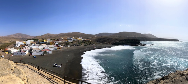
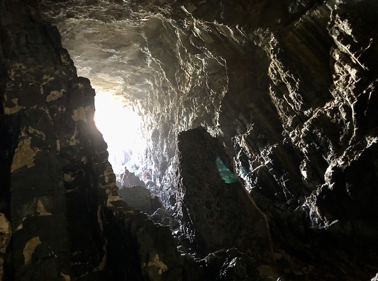
I was surprised about all the restaurants and bars in the small village. After walking around, I found the reason: The caves of Ajuy seemed like a famous tourist attraction.
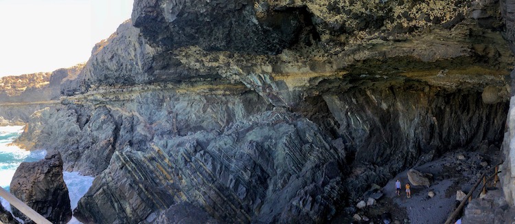
The gigantic caves are up to 40 meters high and some of them are accessible. The sea water and the darkness created a mystic atmosphere inside the caves.
Reaching the South
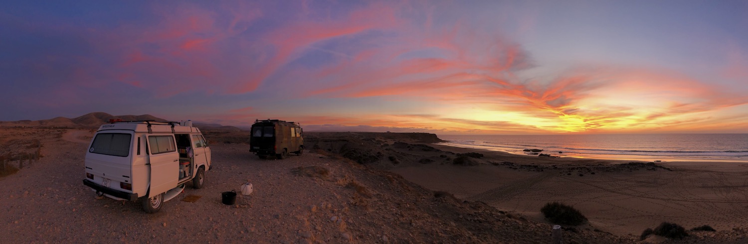
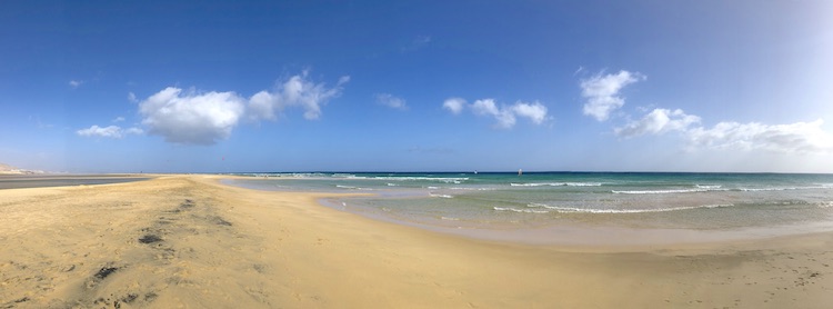
After passing Costa Calma which seemed full of hotels, I stopped at Playa de Sotavento. The lagoon was perfect for wind and kite surfers.
The beach seemed endless. At least, that was what I thought before seeing Playa de Cofete on the other side of the mountain range:
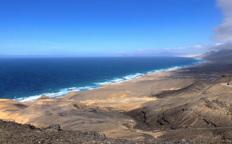
More than 11km of white sand and blue ocean. ![]()
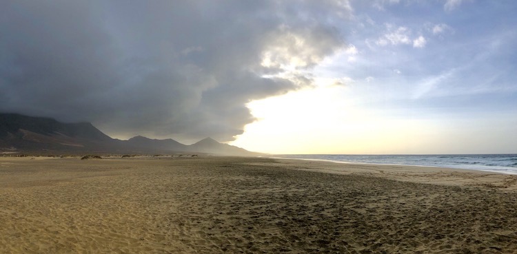
The parking lot in front of the beach was quite busy when I arrived. However, most of the visitors just stayed for a short while, so my last night on Fuerteventura at Playa de Cofete was very calm and peaceful.
On the next day, I took the ferry from Morro Jable to Gran Canaria. It’ll be a very short stay before I’m going to meet some friends vacationing on Tenerife.